 Gallopa
Horse riding in Lower Saxony, Germany
Rides in Lower Saxony, Germany recorded with the Gallopa app and published by their riders: where they went, how far, and how much of it was trot and canter.
23 rides recorded by 13 riders, 210 km in total, average 9.2 km per ride. The longest is Nachmittagsritt at 24.9 km. Across these rides 11% of the moving time was trot and 5% was canter or gallop. Rides are near Langwedel, Wagenfeld, Sulingen, Lathen, Isernhagen Farster Bauerschaft, Jesteburg and more.
Rides in Lower Saxony, Germany
Horse riding near Langwedel
Horse riding near Wagenfeld
Horse riding near Sulingen
Horse riding near Lathen
Horse riding near Isernhagen Farster Bauerschaft
Horse riding near Jesteburg
Horse riding near Haren
Horse riding near Schöningen
Horse riding near Nordstemmen
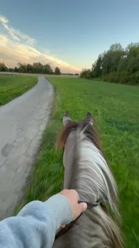
Horse riding near Ebstorf
Horse riding near Stuhr
What a public ride shows
Every ride here was recorded in the Gallopa app on an iPhone or Apple Watch and published by the rider. A ride page shows the GPS route coloured by gait, the distance, the moving time, the average and top speed, the climb, and how long the horse spent in walk, trot, canter and gallop. Riders can hide the start and end of a route, or the whole route, and a page only exists while the rider keeps the ride public.
Questions
Where can I go horse riding in Lower Saxony, Germany?
Riders on Gallopa have published 23 rides in Lower Saxony, Germany, near Langwedel, Wagenfeld, Sulingen, Lathen, Isernhagen Farster Bauerschaft, Jesteburg. Open any ride below for the exact route, its length and how much of it was walk, trot and canter. For horse riding places near you, get the Gallopa app: it shows public rides and riders around you and records your own.
Are there horse riding trails near Langwedel?
Yes. One public ride was recorded near Langwedel, for example Nachmittagsritt at 7.3 km with 44:02 of moving time. Open it for the route.
Are there horse riding trails near Wagenfeld?
Yes. One public ride was recorded near Wagenfeld, for example Nachmittagsritt at 10.2 km with 2:00:30 of moving time. Open it for the route.
Are there horse riding trails near Sulingen?
Yes. 3 public rides were recorded near Sulingen, for example Abendritt at 12.4 km with 1:52:54 of moving time. Open it for the route.
How do I find horse riding places near me in Lower Saxony, Germany?
Two ways. Browse here: every public ride is placed by the nearest town to its route, so a country or region page is a map of where riders actually go. Or get the free Gallopa app on iPhone: it records your own rides, shows the public rides and riders around you, and lets you follow the riders whose routes you like.
Where do people ride horses in Lower Saxony, Germany?
The 23 rides on this page are near Langwedel, Wagenfeld, Sulingen, Lathen, Isernhagen Farster Bauerschaft, Jesteburg. Each one opens to the full route, so you can see which tracks, bridleways and beaches riders actually use.
How far is a typical ride in Lower Saxony, Germany?
9.2 km on average, 210 km across all 23 rides, with 26:20:50 of moving time in total. The longest is 24.9 km.
Can I ride these routes myself?
The line on a ride page shows where a rider went; it is not a right of way. Check local access rules, ask before riding private land, and record your own ride with Gallopa so the next rider can see it too.
Is a rider's location public when they publish a ride?
Only what the rider allows. The app cuts the route inside a privacy zone around the start and end by default, a rider can hide the whole route, and the place name on a page is the nearest town to the route, never an address.
How do I get my ride on this page?
Record the ride with Gallopa on iPhone or Apple Watch, then tap Publish on the finished ride. The page appears within minutes with the route, the distance and the time in each gait, and it disappears the moment you make the ride private again.